مجله نقشه برداری Coordinates
مجله نقشه برداری Coordinates یک ماهنامه اختصاصی می باشد. این ماهنامه در زمینه موقعیت یابی ، ناوبری ، فناوری ها و برنامه های مرتبط است. تمرکز این ماهنامه نقشه برداری بر سیستم های LBS / GPS / GALILEO / GLONASS / و سایر سیستم های GNSS متمرکز است. همچنین این مجله فناوری ها و برنامه های مرتبط مانند سیستم های تهیه نقشه ، نقشه برداری ، کارتوگرافی ، زمان و غیره را نیز در بر می گیرد. همچنین مقالات در زمینه GIS ، سنجش از دور ، LIDAR ، فتوگرامتری , Geospatial Data و غیره و همچنین کاربردهای آنها را در محتوای خود گنجانده است.
مجله نقشه برداری Coordinates یک ماهنامه بین المللی است که قصد دارد این فناوری ها را از حوزه متخصصان به حوزه استفاده کنندگان بالقوه ببرد. این مجله قصد دارد افق نقشه برداری را گسترده تر كند و با آشنایی با بومی سازی این فن آوری ها و کاربرد آن ها در زمینه های مختلف موجود مخاطبین جدیدتر و هدفمندتری را جلب نماید.
“مجله نقشه برداری Coordinates متعهد هست كه اطلاعات آموزشی با کیفیت را برای خوانندگان خود ارائه دهد و برای تبلیغ كنندگان ارزش قائل می باشد” ، مجله Coordinates Magazine به طور كامل به همراه تبلیغات آن به صورت رایگان در سایت کوردینتس قابل بارگیری است. این مجله نقشه برداری به طور گسترده در آسیا ، استرالیا ، نیوزیلند ، اروپا ، شمال آمریکا و سایر نقاط جهان منتشر شده است.
آخرین شماره از مجله Coordinates شامل نسخه الکترونیکی ماهانه به صورت PDF را می توانید بصورت رایگان از سایت disto.ir دانلود نمایید.

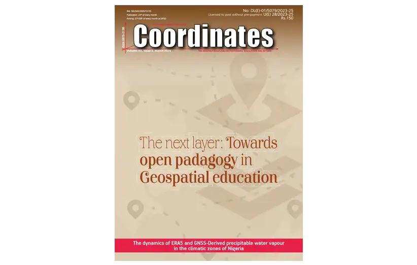
Volume XX, Issue 3, March 2024
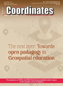
در این شماره از مجله نقشه برداری Coordinates ماه مارس 2024 می خوانید:
GNSS constellation specific monthly analysis summary: February 2024
Narayan Dhital
The next layer: Towards open pedagogy in geospatial education
David Ray Abernathy
The Dynamics of ERA5 and GNSS-Derived Precipitable Water Vapour in the Climatic Zones of Nigeria
Ojegbile, B.M., Okolie, C.J., Omogunloye, O.G., Abiodun, O.E. and Olaleye, J.B.
Volume XX, Issue 2, February 2024
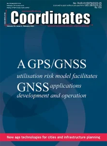
در این شماره از مجله نقشه برداری Coordinates ماه فوریه 2024 می خوانید:
A GPS/GNSS utilisation risk model facilitates GNSS applications development and operation
Renato Filjar, Igor Klopotan, Nenad Sikirica and Ivan Hedji
GNSS constellation specific monthly analysis summary: January 2024
Narayan Dhital
New age technologies for cities and infrastructure planning
A K Jain
The contributions of space geodesy to the construction of sustainable cities in Africa and around the world
Kêmy Elary Mahugnon ADJAGAN and Jean Raphaël ADELAKOUN
Constraints of surveying and mapping Awareness in Nigeria: A comprehensive review
Godwill Tamunobiekiri Pepple, Deborah Gold Alapa, Henry Omoloize Irumhe and Yokyshor Lifu
Volume XX, Issue 1, January 2024
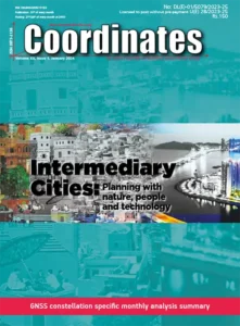
در این شماره از مجله نقشه برداری Coordinates ماه ژانویه 2024 می خوانید:
Intermediary Cities: Planning with nature, people and technology
GNSS constellation specific monthly analysis summary
Intermediary Cities: Planning with Nature, People and Technology A K Jain 5 Land administration
and Geospatial information hard talk: Reviewing the posted comments Dr. Anthony Beck, Vlad imir V. Evtimov and Dr. Keith Clifford Bell 14 GNSS constellation specific monthly analysis summary: December 2023 Narayan Dhital 20 Spin axis Dav id Learmount 23 Galileo HAS will be the most significant gamechanger for mobile GIS users Jean-Yves 26 Future Advanced Air Mobility – The next big challenge for GNSS & GeoSpatial Industries Graeme Hooper 27
Volume XIX, Issue 12, December 2023
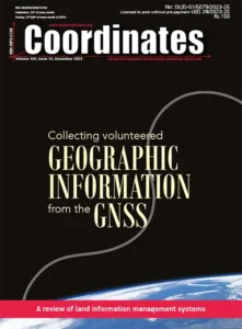
در این شماره از مجله تخصصی نقشه برداری Coordinates ماه دسامبر 2023 می خوانید:
Collecting volunteered geographic information from the Global Navigation Satellite System
See, Benedikt Soja, Grzegorz Klopotek, Tobias Sturn, Rudi Weinacker, Santosh Karanam, Ivelina Georgieva, Yuanxin Pan, Laura Crocetti, Markus Rothacher, Vicente Navarro, Steffen Fritz and Ian McCallum
A review of land information management systems
Ifeanyichukwu Valentine Nwafor, Raphael Oshiobugie Sado and Inipami Prince Johnnie
Volume XIIX, Issue 11, November 2023
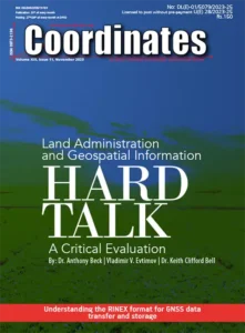
در این شماره از مجله تخصصی نقشه برداری Coordinates ماه نوامبر 2023 می خوانید:
Land Administration and Geospatial Information Hard Talk: A Critical Evaluation
Anthony Beck, Vladimir V. Evtimov and Keith Clifford Bell
Understanding the RINEX format for GNSS data transfer and storage
Volker Janssen
The ubiquitous dimensions of Surveying and Mapping deliverables in Nigeria
Pepple, G. T., Udoh, O. J., West, E. B., and Lazarus,
Volume XIX, Issue 10, October 2023
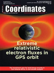
در این شماره از مجله تخصصی نقشه برداری Coordinates ماه اکتبر 2023 می خوانید:
Extreme Relativistic Electron Fluxes in GPS Orbit: Analysis of NS41 BDD-IIR Data
Nigel P. Meredith, Thomas E. Cayton, Michael D. Cayton and Richard B. Horne
The Investment Case for Land Tenure Security in Sub-Saharan Africa: A Cost-Benefit Analysis
Frank F K Byamugisha and Nancy Dubosse
Volume XIX, Issue 9, September 2023
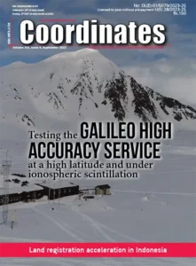
در این شماره از مجله نقشه برداری Coordinates ماه سپتامبر 2023 می خوانید:
Testing the Galileo High Accuracy Service (HAS) at a High Latitude and under Ionospheric Scintillation
Melania Susi, Daniele Borio, Althaf Azeez, Jihye Park, Kinga Wc˛ zka and Ignacio Fernandez-Hernandez
Land registration acceleration in Indonesia: lessons learnt from land registration system in Malaysia
Ricco Survival Yubaidi, Mazliza Mohamad and Saidatul Nadia Abd Aziz
The Investment Case for Land Tenure Security in Sub-Saharan Africa: A Cost-Benefit Analysis
Frank F K Byamugisha and Nancy Dubosse
Volume XIX, Issue 8, August 2023
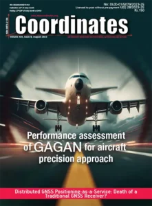
در این شماره از مجله تخصصی نقشه برداری Coordinates ماه آگوست 2023 می خوانید:
Distributed GNSS Positioning-as-a-Service: Death of a Traditional GNSS Receiver?
Renato Filjar, Filip Šklebar and Ivica Zubic
GAGAN Performance Assessment for Aircraft Precision Approach
Narayan Dhital
An architecture for a visual-based PNT alternative
Joshua J R Critchley-Marrows, Xiaofeng Wu and Iver H Cairns
The proposed GNSS Positioning-as-a-Service emerges as a groundbreaking novelty, providing numerous benefits and advantages, while opening widely the room for robust and QoS-guaranteed GNSS applications development and operations.
Volume XIX, Issue 7, July 2023
در این شماره از مجله نقشه برداری Coordinates ماه جولای 2023 می خوانید:
Volume XIX, Issue 6, June 2023
در این شماره از مجله نقشه برداری Coordinates ماه ژوئن 2023 می خوانید:
Surveying In NIGERIA.
Academic and Professional Challenges.
Volume XIX, Issue 5, May 2023
در این شماره از مجله نقشه برداری Coordinates ماه می 2023 می خوانید:
Developing GNSS GHANA Software.
Development of GNSS software for Ghana Survey and Mapping Division
Gameti Charles, Acheampong Akwasi Afrifa, John Ayer
Energy transition in Nigeria: A technological and philosophical perspective
Mike Iroh
Volume XIX, Issue 4, April 2023
در این شماره از مجله نقشه برداری Coordinates ماه آپریل 2023 می خوانید:
Protecting GNSS Against International interference.
National Geospatial Policy, 2022: An urban perspective
Dr Mahavir and Dr Prabh Bedi
Protecting GNSS against intentional interference
Arul Elango, Ahmed Al-Tahmeesschi, Mikko Saukkoriipi, Titti Malmivirta and Laura Ruotsalainen
Dual-Frequency EGNOS and Galileo-based GNSS Receiver and Antenna for Railway: TRENI Project
Marco Puccitelli, Chiara Manno, Livio Marradi, Gaetano Pastore, Hanaa Al Bitar, Anne Marie Tobie, Rodolfo Guidi, Giovanni Galgani, Francesco Inzirillo, Filippo Rodriguez, Alessio Martinelli, Yuval B. Yossef and Daniel Lopour
Volume XIX, Issue 3, March 2023
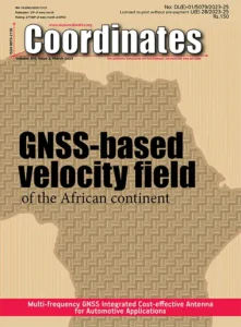
در این شماره از مجله نقشه برداری Coordinates ماه مارس 2023 می خوانید:
GNSS-Based Velocity Field of the African Continent.
Volume XIX, Issue 2, February 2023
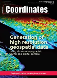
در این شماره از مجله نقشه برداری Coordinates ماه فوریه 2023 می خوانید:
Generation of high resolution geospatial data using airborne topographic LiDAR and digital camera
Datasets acquired from Airborne lidar and digital camera enabled to generate high resolution digital terrain models with an accuracy of 35cm, large scale maps in 1:5000 scale and 2.5D building database for narrow corridor of 2km along the entire Indian main land coast of ~5000 km for an extent of ~24000 sq.km covered with complex features and terrain. Data has been utilized in generation of tsunami models at local scale for different magnitudes of earthquakes, preparation of multi hazard vulnerability maps for oceanogenic disasters, to assess disasters
at micro-level and planning the mitigation.
Volume XIX, Issue 1, January 2023
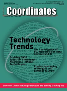
در این شماره از مجله نقشه برداری Coordinates ماه ژانویه 2023 می خوانید:
The Convergence of 5G, high precision data delivery and AI
Arn Hayden and Brandon Sights
Evolving GNSS Spectrum Situational Awareness / RADAR Technologies
Graeme Hooper
Precise positioning techniques will continue to grow
Andy Proctor
Survey of leisure walking behaviours and activity tracking use
James Williams, James Pinchin, Adrian Hazzard and Gary Priestnall
Urban informatics for sustainable and smart cities
A K Jain
Volume XVIII, Issue 12, December 2022
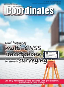
در این شماره از مجله نقشه برداری Coordinates ماه دسامبر 2022 می خوانید:
Positioning performance evaluation of a dual frequency multi-GNSS smartphone
TILL WEIGERT AND GUENTHER RETSCHER
Use only horizontal ground distance [not grid distance] dimensions in land surveys
JOHN READ
Animal navigation: how animals use environmental factors to find their way
ROSWITHA WILTSCHKO AND WOLFGANG WILTSCHKO
Volume XVIII, Issue 11, November 2022
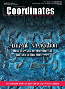
در این شماره از مجله نقشه برداری Coordinates ماه نوامبر 2022 می خوانید:
Assessment of the completion of the forest cadastre considering the legal grounds, collaboration, and the use of technology
Orhan Ercan and Nur Kemalettin Toker
On the applicability of integrated UAV photogrammetry and automatic feature extraction for cadastral mapping
Oluibukun Gbenga Ajayi and Emmanuel Oruma
Animal navigation: how animals use environmental factors to find their way
Roswitha Wiltschko and Wolfgang Wiltschko
Volume XVIII, Issue 10, October 2022
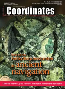
در این شماره از مجله نقشه برداری Coordinates ماه اکتبر 2022 می خوانید:
Cadastre forensics, para surveyor and mobile app for land registration
Trias Aditya
The Antikythera Mechanism: Discerning its role in ancient navigation
James E. (Jim) Wyse
Integrated UAV photogrammetry and automatic feature extraction for cadastral mapping
Oluibukun Gbenga Ajayi and Emmanuel Oruma
Volume XVIII, Issue 9, September 2022
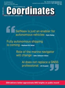
در این شماره از مجله نقشه برداری Coordinates ماه سپتامبر 2022 می خوانید:
DEM delivers better approximate AHD heights on public record
Jonathon Smith and Volker Janssen
Generalized orthogonalization an elegant solution to the least squares problem
Joël van Cranenbroeck
Volume XVIII, Issue 8, August 2022

در این شماره از مجله GPS نقشه برداری Coordinates ماه آگوست 2022 می خوانید:
Laser scanning in archaeology and cultural heritage documentation
Hina Pande, Poonam Seth Tiwari and Shefali Agarwal
NRTK observations and their uncertainties in a modern datum
Tom Bernstein and Volker Janssen
New insights into large tropical tree mass and structure from direct harvest and terrestrial lidar
Andrew Burt, Matheus Boni Vicari, Antonio C L da Costa, Ingrid Coughlin, Patrick Meir, Lucy Rowland and Mathias Disney
Volume XVIII, Issue 7, July 2022

در این شماره از مجله نقشه برداری Coordinates ماه جولای 2022 می خوانید:
EN16803 European geolocation standard to certify mobility solutions
Xavier Leblan, Giuseppe Rotondo, Miguel Ortiz and Christelle Dulery
Logistics tracking system based on decentralized IoT and blockchain platform
Marouane El Midaoui, El Mehdi Ben Laoula, Mohamed Qbadou and Khalifa Mansouri
Analysis of factors affecting industrial site selection in Hawassa town, Ethiopia
Muluneh Beyene Tsala
Volume XVIII, Issue 6, June 2022
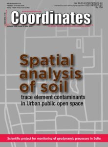
در این شماره از مجله GPS نقشه برداری Coordinates ماه ژوئن 2022 می خوانید:
Scientific project for monitoring of geodynamic processes in Sofia
Nikolay Dimitrov
Spatial analysis of soil trace element contaminants in urban public open space
Andrew W Rate
Mapping physical development changes using Geospatial techniques
Leonard Michael Onyinyechi Aminigbo
Forest Survey of India says forest cover estimate is done with field data tallied with Satellite based Interpretation.
amid criticism from experts of its methodology to map forest cover in the country, the Forest Survey of India (FSI) has said that the forest cover is estimated from the field inventory data, which corroborate the figures obtained from satellite-based interpretation. It claimed that the criticism of its findings was based on perception and done more to generate sensation.
Volume XVIII, Issue 5, May 2022
در این شماره از مجله حرفه ای نقشه برداری Coordinates ماه می 2022 می خوانید:
Local Moho estimation using gravity inversion
H M I Prasanna
Evaluation of KSACORS-based network GNSS-INS integrated system for Saudi coastal hydrographic surveys
Mohammed El-Diasty
Mapping the urban atmospheric carbon stock
MD Abdul Mueed Choudhury, Ernesto Marcheggiani, Andrea Galli, Giuseppe Modica and Ben Somers
Is India’s forest cover really increasing? Official maps don’t tell you the whole truth
M D Madhusudan, T R Shankar Raman
Thales partners with ESA on Galileo cybersecurity and enhancements As part of G2G IOV SECMON, Thales is leading the consortium, including the Italian group Leonardo, to expand the scope of security monitoring and include the new assets in the G2G system. It will also introduce automated incident response and network traffic monitoring. In addition, the solution will be capable of storing significant amounts of incident response data. To meet this challenge, Thales will deliver a solution built on a scalable, flexible architecture derived from its Cybels range of security supervision products and incorporating big data capabilities.
Volume XVIII, Issue 4, April 2022

در این شماره از مجله نقشه برداری Coordinates ماه آپریل 2022 می خوانید:
LiDAR in oil palm disease detection
Nur Azuan bin Husin and Siti Khairunniza Bejo
Spatial and economic inequities and trends in South Africa
Sue Bannister, Michael Sutcliffe and Willy Govender
Mapping the urban atmospheric carbon stock
MD Abdul Mueed Choudhury, Ernesto Marcheggiani, Andrea Galli, Giuseppe Modica and Ben Somers
Most municipalities do not currently charge property rates in former black townships. This is a response to high levels of poverty in these areas as well as to the fact that many townships do not have freehold tenure as they are located on traditional land. However this also allows for a situation where new housing is developed in these areas specifically because the owners do not have to pay for property rates.
Volume XVIII, Issue 3, March 2022
در این شماره از مجله تخصصی نقشه برداری Coordinates Magazine ماه مارس 2022 می خوانید:
Aviation prepares to reorientate
Review of Continuously Operating Reference Stations activities in India
Aviation prepares to reorientate
David Learmount
Package of approved revised ITU-R Recommendations on RNSS systems
Review of Continuously Operating Reference Stations activities in India
Subhalakshmi Krishnamoorthy
Spatial analytics for a resilient and low carbon urban India
A K Jain
Digital Twin: A Promising and futuristic integrated technology for digital transformation
Komal S Pawar
For investigation of earthquakes based on their affine degrees-of-freedom, methodology of another field –anatomy – is highly relevant. Instead of designated landmark sets coming from a group of patients, here they are associated with a series of days (e.g., from several days before to several days after a quake). Each landmark set is then subjected to a sequence of procedures thoroughly familiar to anatomy experts and succinctly reviewed herein.
Volume XVIII, Issue 2, February 2022

در این شماره از مجله GPS نقشه برداری تخصصی Coordinates ماه فوریه 2022 می خوانید:
A New Kind of City Science Build on Living Structure
Cryptographic digital technology for the prevention of property theft
A new C++ programming course in action at Moscow University of Geodesy and Cartography
V R Zablotskii
Cryptographic digital technology for the prevention of property theft
Jethro Jones
Emerging IoT paradigm – A technology perspective
Patrick Marv Casiano
A new kind of city science built on living structure and on the third view of space
Bin Jiang
China’s Space Program: A 2021 perspective
Volume XVIII, Issue 1, January 2022
در این شماره از مجله تخصصی نقشه برداری Coordinates ماه ژانویه 2022 می خوانید:
Technology Trends, Drone reducing workplace hazards, 3D mapping systems, Metverse vs. Omniverse, Augmented Positioning Services
FPGA implementation of a NavIC-disciplined 10MHz reference
Let the Metaverse v/s Omniverse race begin!
Graeme Hooper
Technology trend in 3D mapping systems for mining
Giorgio Vassena
5 ways drones are improving workplace safety standards
James Rennie
High-accuracy augmented positioning services will become the new normal
Guy Buesnel
Geo-spatial big data analysis of Covid-19 spectrum envelope of first and second wave of the outbreak in the SE Asian region
Wapangsenla Imchen, Aditi Verma, Resenmenla Longchar, Aosenla Pongen and Arun Kumar Verma
Humorous science: Work health and safety
Volker Janssen
FPGA implementation of a NavIC-disciplined 10MHz reference for SATCOM networks
Kriti Khatri, M R Sujimol, Urvashi Bhat and K Shahana

