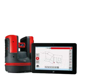

نرم افزار MicroSurvey FieldGenius
انتشار بروز رسانی نرم افزار MicroSurvey FieldGenius
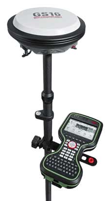
نرم افزار MicroSurvey FieldGenius 11.6.0.781 نسخه جدید، توسط کمپانی Microsurvey کانادا منتشر گردیده است. نرم افزار ماکروسرویی فیلدجنیوس یک نرم افزار قدرتمند با تمام ویژگی های نسخه های پیشین برای نقشه برداران حرفه ای می باشد.
این نسخه از نرم افزار MicroSurvey FieldGenius برای دستگاه های هوشمند دارای سیستم ویندوز موبایل 7 به بالا طراحی گردیده است.
نسخه تبلتی نرم افزار MicroSurvey FieldGenius قابلیت نصب بر روی ویندوز 10 و همچنین نسخه های پیشین ویندوز (8.1 و 7) را دارا است.
نرم افزار ماکروسرویی فیلدجنیوس 11 با دو ورژن 32bit و 64bit سازگار می باشد.

نرم افزار ماکروسرویی فیلدجنیوس
منبع : سایت ماکروسرویی ایران
برای خرید نرم افزار MicroSurvey FieldGenius با بخش پشتیبانی ماکروسرویی ایران در تماس باشید.
دانلود لیست بروز رسانی ماکروسرویی فیلدجنیوس : Microsurvey FieldGenius 11.6.0.781 Software
MicroSurvey and FieldGenius are registered with the U.S. Patent and Trademark Office by MicroSurvey Software Inc.
© 2023 MicroSurvey Software Inc.
تغییرات اعمال شده در بروز رسانی جدید نرم افزار ماکروسرویی فیلدجنیوس 11.6.0.781 به شرح ذیل می باشد :
FieldGenius 11.6.0.781 – Release Notes June 30, 2023
NEW FEATURES
• Keyboard Shortcuts– Added Total Station Offset and Rotate instrument functions to the keyboard
shortcuts list
• Slope staking – Updated slope staking routine to show slope distance
• ASCII Export – Export precision now matches project precision
• Multiline – expanded existing group code function to support multiline when using Total Stations
• SmartNet Global PPP – added support for Smartnet Global PPP service
• Staking list – option to sort the staking list by a range of points
• Raw file Export – A new record comment is added when a user uses Reset RTK filter’s function
NEW AND UPDATED INSTRUMENT DRIVERS
GNSS
• ComNav – Support for QZSS constellation system
• Leica- Dual base mode function to support external radio + GSM configurations concurrently.
• FOIF A90 – updated antenna offset parameters
• GeoMax Zenith 60 – IMU Calibration tool added
• Hemisphere S631 – IMU Calibration tool added
• Pentax– Support for QZSS constellation system
• Stonex IMU Receivers – IMU Calibration tool added
Total Station
• FOIF RTS 362 – Fixed issue with battery level for onboard instruments
• South NTS New – added new driver
COORDINATE SYSTEMS
• Gugik-evrf2007 – new geoid model for Poland
• RAF20 – New Geoid for France
• Ohio – New low distortion systems for each county
• Greece-EGSA87 – New Coordinate system added
DEFECTS FIXED
• Scale Factor – Addressed issue with scale factor not being applied consistently throughout staking
functions
• Group Codes – Addressed issue with group codes not saving
• GNSS Offset Measurement – addressed issue with direction when local transformation applied
• SDR Export – updated total station observation data to output decimal degrees
KNOWN ISSUES
• Line Staking – issues with staking feedback not updating to the next segment when staking closed
figures
• Disto S910 – First photo taken with project can provide an error, additional photos are taken and stored
fine.
• Photo Notes – Camera rotation is not supported.
• LandXML – LandXML alignments containing a sequence of Spiral-Curve-Spiral-Curve-Spiral are not
properly displayed.
• Multiset Structured – Angle only backsight is not available.
Microsurvey FieldGenius 11.5.0.692 Software released on March 23, 2023
NEW FEATURES
• AP20 Support – Added support for Auto Pole available for Leica Total Stations
• Depth sounder Export – Updated exports to include depth sounder export
NEW AND UPDATED INSTRUMENT DRIVERS
GNSS
• Hemisphere S631 – Support for BDS constellations
Total Station
• South NTS New – added new driver
COORDINATE SYSTEMS
• SLOVRP2016 – new geoid model for Slovenia
• Local Grid Mauritius 2012 – added new coordinate system
DEFECTS FIXED
• Deleting multiple points – Addressed with deleting multiple points not deleting full selection
• GNSS Offset Measurement – addressed issue with height computation not applying localization
parameters
KNOWN ISSUES
• Disto S910 – First photo taken with project can provide an error, additional photos are taken and stored
fine.
• Photo Notes – Camera rotation is not supported.
• LandXML – LandXML alignments containing a sequence of Spiral-Curve-Spiral-Curve-Spiral are not
properly displayed.
• Multiset Structured – Angle only backsight is not available.
Microsurvey FieldGenius 11.3.0.383 Software released on June 21, 2022
New Features
- Slope Area – Added new computation for showing sloped areas
- Line Staking Settings – Line Stake settings are now stored and no longer reset back to the default
- DXF/DWG Importer – Updated CAD importer to remove external window that was appearing
- NTRIP Configuration – Updated our NTRIP configuration to support TLS casters
New and Updated Instrument Drivers
GNSS
- Alpha-geo L6U – Added new driver
- eSurvey E200 – Added new driver
- eSurvey E500 – Added new driver
- Geneq SXblue Smart – Added new driver
- Pentax G7H – Added new driver
- proNIVO PNR21 – Added new driver
- South RTK (IMU) – Updated driver to support latest firmware updates
- Stonex S580 – Added new driver
Total Station
- eSurvey E3L – Added new driver
Coordinate Systems
- Nova Scotia ATS77 Zone 4 (2010)- Updated system parameters
- Nova Scotia ATS77 Zone 4 (1997)– Updated system parameters
- SWEN17_RH2000 – Added local geoid model for Sweden
Defects Fixed
- GNSS Offset – Addressed issue when local transformation is applied using a feet
- Existing Point ID dialog – Addressed issue where some point id’s got cut off
- Importing DXFs – Addressed issue with not displaying arc entities with a radius less than 40 m
Known Issues
- Disto S910 – First photo taken with project can provide an error, additional photos are taken and stored
- Photo Notes – Camera rotation is not
- LandXML – LandXML alignments containing a sequence of Spiral-Curve-Spiral-Curve-Spiral are not properly displayed.
- Multiset Structured – Angle only backsight is not
Microsurvey FieldGenius 11.2.0.226 Software released on February 22, 2022
NEW FEATURES
• DXF/DWG By Layer export – added By Layer support to export colors configured to layers set by the AutoMap file
NEW AND UPDATED INSTRUMENT DRIVERS GNSS
• Tersus Oscar – Add support for additional UHF frequencies in the predefined list
• Leica GS16/18 – Added support for Multipath reduction function.
• Stonex S900A – updated raw file NGS ID note record
• ComNav RTK (IMU) – Addressed performance issues with IMU calibration
Coordinate Systems
• FIN2005N00/ Fin2000 – Added local Geoid models for Finland
• Cyprus – Added local geoid model for Cyprus
DEFECTS FIXED
• Roading Template – Addressed formatting issues displayed in the template fields.
• Reciprocate Traverse – updated function to prevent users from using a different setup pair.
• Importing DXFs – Addressed issue with not displaying arc entities with a radius less than 0.40 m
KNOWN ISSUES
• Alpha-geo L8 + Netbox1 – known issue with IMU calibration required after reconnecting.
• Disto S910 – First photo taken with project can provide an error, additional photos are taken and stored fine.
• Photo Notes – Camera rotation is not supported.
• LandXML – LandXML alignments containing a sequence of Spiral-Curve-Spiral-Curve-Spiral are not properly displayed.
• Multiset Structured – Angle only backsight is not available.
Microsurvey FieldGenius 11.1.1.0 Software released on November 3, 2021
NEW FEATURES
Display E-bubble – Updated the UI to display the e-bubble on the instrument toolbar when tilt correction is enabled Perpendicular Offset – updated the default setting to enhance the efficiency of using the feature
NEW AND UPDATED INSTRUMENT DRIVERS
GNSS
Alpha-geo L8 – Added new driver Alpha-geo NetBOX1+ NetBOX1 Pro – Added new driver CHC i73 – updated driver to fix crash result when receiver battery depletes ComNav RTK + RTK (IMU) – Added new generic RTK & RTK (IMU) driver options to support all ComNav receivers. GeoMax Zenith 60 – Added new driver Gintec G20 + G20M – Added new driver KQGEO M8Mini (IMU) – Added New Driver South RTK – Added new generic RTK driver to support all South receivers with no tilt support South Galaxy G1– Fixed issue where an LSQ error would appear on the receiver South Splice Plate Offset – Corrected an incorrect splice offset parameter Tersus Oscar – Updated driver to support requesting NTRIP source table
Total Station
E-Survey E3 – Added new driver GeoMax Zoom 75/95 – Added new driver Sanding Arc5 Pro – Added new driver
Coordinate Systems
MGA 2020 Systems – Added MGA 2020 systems to the Australian coordinate systems group State Planes NAD83-TX83-NC – Updated coordinate system extents to resolve an issue with some GNSS positions falling outside of the projection.
DEFECTS FIXED in MicroSurvey FieldGenius Software 11.1.1.0
DWG Import – Resolved issue with some 2018 .dwg’s unable to import. GNSS Transformation – Fixed issue where some points were ignored being translated GNSS Offset Measurement – Fixed issue with offsets being computed when a local transformation is applied Point Averaging – Fixed issue where point averaging would cause a crash Scale Factor Reset – Fixed issue where the scale factor would get reset if user selected a LandXML
Known Issues
Disto S910 – First photo taken with project can provide an error, additional photos are taken and stored fine. Photo Notes – Camera rotation is not supported. LandXML – LandXML alignments containing a sequence of Spiral-Curve-Spiral-Curve-Spiral are not properly displayed. Multiset Structured – Angle only backsight is not available.
Posibility to open fieldgenius files in STONEX cube manager software for post processing and perform cad works.
You can read more about this software in Latest FieldGenious Release note 11 in our site.
Microsurvey FieldGenius 11.0.2 Software released on April 26, 2021
NEW FEATURES
FieldGenius Basic License – New Licence Option
Tangent to Circle Intersection – Added a New Tangent to Circle calculation tool
2018 .DWG File Support – Support for importing 2018 .DWG files
NEW AND UPDATED INSTRUMENT DRIVERS
GNSS
- Stonex S980A – Added New
- CHC i73 – Added New Driver
- Pentax G7 – Added New Driver
- Pentax G6J2 – Added New Driver
- E-Survey E-500 – Added New Driver
- GeoMax Zenith 40 – Added Terrastar Support
- GeoMax Zenith 35 – RINEX 2 Raw Data Logging Support
- Tersus Oscar – Add support for CMR or RTD Correction Format When Configuring Reference Station
Total Station
- E-Survey E3 – Added New
Coordinate Systems
- SLD 99 System – Update to the SLD 99 Sri Lankan system to resolve computation
- Barbados National Grid System – Added support for Barbados National Grid System
- Japan Coordinate Systems – Updates to the Japan coordinate systems to reflect updated shifts in the region.
- Romania70 – Updates to the coordinate dictionaries to address a translation
- Hungary-Vitel2014 – Updates to the system to address an issue with computing positions in certain areas.
DEFECTS FIXED in MicroSurvey FieldGenius Software 10.4.1.2
- LandXML Surface Import – Fixed issue where TIN surface models are not preserved on
- DWG/DXF Import – Resolved issue with coordinates being rounded when importing circle
- Tersus Oscar – Resolved issue when setting up reference station to use the correct
- MDOT Cutsheet Report Export – Fixed issue where the offset values were recorded incorrectly
- Local Transformation – Resolved issue when having a RTS transformation applied along with a local transformation no longer reverts the RTS transformation parameters
Known Issues
CHC i90 – IMU tilt compensation issues when position update rate not set to 1Hz
Disto S910 – First photo taken with project can provide an error, additional photos are taken and stored fine.
Photo Notes – Camera rotation is not supported.
LandXML – LandXML alignments containing a sequence of Spiral-Curve-Spiral-Curve-Spiral are not properly displayed.
Multiset Structured – Angle only backsight is not available.
NEW FEATURE AND DRIVER DETAILS
none
Microsurvey FieldGenius 10.4.1.2 Software released on August 21, 2020
NEW FEATURES
This is a service pack release for FieldGenius to add support for new survey instruments and fix high priority defects.
NEW AND UPDATED INSTRUMENT DRIVERS
GNSS
- CY F100 – Added New Driver.
- Hemisphere S631 GNSS – Added New Driver.
- Tersus GNSS Devices – Updated reference distance for GNSS.
- GENEQ F100 – Updated Driver.
- Leica Devices – Add support for Satel 900MHz Radio.
- Tersus – Add support for GSA and GSV messages.
- Stonex – Add S990A and S980 – Added New Driver.
- KOLIDA K1PRO and K20s – Added New Drivers.
- CHC i80 – Updated driver to support new firmware version.
Total Station
- CHC CTS-112R4 – Added New Driver.
Coordinate Systems
- No new coordinate system updates.
DEFECTS FIXED in MicroSurvey FieldGenius Software 10.4.1.2
- Observation Toolbar – Fixed bug when switching to staking mode.
- Changing GNSS Tolerance – Fixed wait dialog does not close issue.
- eSurvey E100 – Updated driver to address GSM issue.
Known Issues
Disto S910 – First photo taken with project can provide an error, additional photos are taken and stored fine.
Photo Notes – Camera rotation is not supported.
LandXML – LandXML alignments containing a sequence of Spiral-Curve-Spiral-Curve-Spiral are not properly displayed.
Multiset Structured – Angle only backsight is not available.
NEW FEATURE AND DRIVER DETAILS
none
Microsurvey FieldGenius 10.4.1.1 Software released on June 24, 2020
NEW FEATURES
This is a service pack release for FieldGenius to add support for new survey instruments and fix high priority defects.
NEW AND UPDATED INSTRUMENT DRIVERS
GNSS
- Topcon HiperII – Add new driver.
- Topcon HiperV – Add new driver.
- Leica – Remove Leica 1100 driver no longer supported device.
Coordinate Systems
- No new coordinate system updates.
DEFECTS FIXED in MicroSurvey FieldGenius Software 10.4.1.1
- FOIF FieldGenius – Fixed issue so the Observation Toolbar shows red.
- ComNav – Fixed Bluetooth connect issue with Windows 10.
- Automap – Fixed window goes full screen no matter the windows settings issue.
- Station / Offset, Ground to Grid scale factor – Fixed issue that the scale factor was not being applied.
- Traverse Report – Fixed issue with the adjustments not being applied to the database.
Known Issues
Disto S910 – First photo taken with project can provide an error, additional photos are taken and stored fine.
Photo Notes – Camera rotation is not supported.
LandXML – LandXML alignments containing a sequence of Spiral-Curve-Spiral-Curve-Spiral are not properly displayed.
Multiset Structured – Angle only backsight is not available.
NEW FEATURE AND DRIVER DETAILS
none
Microsurvey FieldGenius 10.4.1.0 Software released on 27th May, 2020
NEW FEATURES
This is a service pack release for FieldGenius to add support for new survey instruments and fix high priority defects.
NEW AND UPDATED INSTRUMENT DRIVERS
GNSS
- FieldGenius Inverse Function – Added the option to output both metric and imperial
- Tersus – Added tilt functionality for GNSS receivers that use IMU technology to determine
- eSurvey – Added support for the following GNSS receivers:
- E800H
- E800T
Coordinate Systems
- No new coordinate system updates.
DEFECTS FIXED in MicroSurvey FieldGenius Software 10.4.1.0
- Sokkia – Fixed an issue with Sokkia GNSS Receivers displaying the incorrect Slope Distance (SD) value in the Raw File record.
- Stake Elevation – Fixed an issue with the staked results dialog showing the incorrect design elevation value.
- FieldGenius – Fixed an issue that with Autostore enabled and the option to continue applying a note to new observations enabled the note was not being recorded in subsequent new observations.
- South – Fixed a connection issue on Windows 10 devices with the South S660N and Galaxy G1 Plus GNSS receivers.
- ESurvey – Resolved Bluetooth connection issue for the following receivers:
- E600H
- E600T
- E600N
- E300 Pro
- E100
Known Issues
Disto S910 – First photo taken with project can provide an error, additional photos are taken and stored fine.
Photo Notes – Camera rotation is not supported.
LandXML – LandXML alignments containing a sequence of Spiral-Curve-Spiral-Curve-Spiral are not properly displayed.
Multiset Structured – Angle only backsight is not available.
NEW FEATURE AND DRIVER DETAILS
none
Microsurvey FieldGenius 10.4 Software released on 8th April, 2020
NEW FEATURES
This is a service pack release for FieldGenius to add support for new survey instruments, add and update coordinate systems and fix high priority defects.
- Added the ability to save the last selected GNSS update rate for a receiver so the next time the receiver is used the last selected updated rate is
NEW AND UPDATED INSTRUMENT DRIVERS
GNSS
- CHC i90 – Added a new driver with support for IMU tilt
- eGPS eGPS20T – Updated driver with support for IMU tilt
- IGAGE iG9 – Updated driver with support for IMU tilt
- Leica GS07 – Add new
- Bince N90 – Add new
- South S660N – Add new
- Kolida S680N – Add new
- Ruide S680N – Add new
- Sanding S680N – Add new
- SOUTH Galaxy G6 – Updated driver with support for IMU tilt
- Stonex S700A – Add new
- Stonex S850A – Add new
- Stonex S900- Updated driver with support for IMU tilt
- Stonex S900A– Updated driver with support for IMU tilt
- GeoMax Zenith 16 – Added a new
- Geoelectron – Updated the driver to automatically start as an operating base station if it was previously setup up correctly prior to being powered
Coordinate Systems
- Netherlands RDNAP2008 – Added support for gsb.
- Created Korean geoid (2018).
- Added the Cyprus Local Transverse Mercator (CGRS93) to the “EUROPE”
- Austria coordinate system
- Added support for Austria M31 and M34 coordinate
DEFECTS FIXED in MicroSurvey FieldGenius Software 10.4
- GeoMax Zoom 90 – Fixed the Zoom 90 total station storing staked point reverts prism height to
- Tersus – Fixed Oscar geoid undulation
- Data collector internet – Updated support for long user
- Roading – FieldGenius standard license is able to access Roading Module
- CHC – Fixed X91
- South – Fixed GSM connection
- Roads Manager – Fixed issue with roads not being saved to a project after closing
- Leica – Fixed DCI issue with
- Geozone – FalconSF driver update.
Known Issues
Disto S910 – First photo taken with project can provide an error, additional photos are taken and stored fine.
Photo Notes – Camera rotation is not supported.
LandXML – LandXML alignments containing a sequence of Spiral-Curve-Spiral-Curve-Spiral are not properly displayed.
Multiset Structured – Angle only backsight is not available.
NEW FEATURE AND DRIVER DETAILS
none
Microsurvey FieldGenius 10.2.30.3 Software released on 24th April, 2019
NEW FEATURES
ASCII import – Added feature to filter files in a folder to only show .txt and .csv files. The filter can be turned off to show all files in a folder if necessary.
Check backsight target height – New feature to retain the target height when checking the backsight.
NEW AND UPDATED INSTRUMENT DRIVERS
Various instrument drivers have been added and improved.
GNSS
- Stonex S10, S900A, S800A – Added Atlas (LBand)
- ComNav T300, T300 plus – Added RTCM message for MSM4
- South G1, G6 – Updated driver to include distance to reference
- Hemisphere 321 – Updated driver to support Surefix
- GeoMax Zenith 40 – New
Total Station
- Leica iCON iCB30 – New
- Topcon robot driver – Updated driver to improve RC
- Stonex R25 – New
- Stonex R15 – New
- MicroSurvey FieldGenius Software
Coordinate Systems
- France – French coordinate systems 9 zones added to Europe
- France – New French RAF18
- Korea – New Korean KNGeoid18
- Estonia – Updated Estonia geoid
DEFECTS FIXED in Microsurvey FieldGenius 10.2.30.3 Software
- FOIF – Fixed issue with slow measurement
- South S760 – Fixed issue with cellular modem interrupting internet
- South – Fixed issues with GLONASS satellites not been recognized in the
- Sokkia iX – Fixed issues with prism setup and tracking mode losing prism
- Import files – Fixed issue with importing an .xml, .dgn, .dwg, .dxf file when a file of this type already existed in the
- SDR export – Fixed issue with SDR format in RAW
- Export file name keyboard – Fixed issue with the windows soft keyboard being set to off on a tablet but needing the keyboard to enter the export file name in windows
- Offsetting line /arc from a .dxf imported figure – Fixed issue with the arc not creating
- Search button functionality – Improved robotic search button functionality for non-Leica robotic total stations. (9848)