
مجله نقشه برداری Geospatial World
مجله نقشه برداری Geospatial World بازوی رسانه ها و روابط عمومی رسانه ها و ارتباطات در زمینه داده های زمینی در جهان است.
مطالب ارزشمند ما از طریق چندین کانال – به صورت آنلاین ، ویدئویی ، مجله چاپی ، رسانه های اجتماعی ، و ایجاد محتوا و محدودیت های بازاریابی سفارشی – آخرین روندها و تحلیل های فن آوری ، نظرات کارشناسان و حمایت از موضوعات سیاست را ارائه می شود. نویسندگان خبره ، همکاران مهمان از طیف گسترده ای و یک هیئت مشاوره از رهبران برتر اندیشمند در نقشه برداری یک قابلیت استثنایی در صنعت رسانه ای نقشه برداری به ما می دهند.
بازدید از وب سایت مجله نقشه برداری ما:
با میانگین 135000 بازدیدکننده در هر ماه از سایت ما geospatialworld.net ، به راحتی پلتفرم رسانه شماره یک در حوزه داده های زمینی و نقشه برداری است. و منبع موثق اطلاعاتی برای متخصصان در بیش از 150 کشور است. این وب سایت که عناصر متنی ، گرافیکی و ویدئویی را با هم ادغام می کند ، یک وسیله تعاملی برای ذینفعان صنعت geospatial است تا بتواند از طریق چندین ویژگی نوآورانه ، از جمله اخبار ، فیلم ها ، وبلاگ های مهمان ، مطالعات موردی ، مقالات ، مصاحبه ها ، لیست های کسب و کار و رویدادها با هم ارتباط برقرار کنند.
بازدید از صفحه در هر ماه بیش از 220،000 و بازدیدکننده در هر ماه بیش از 135،000 و جلسات در هر ماه بیش از 150،000
بازدید از مجله نقشه برداری ما:
به عنوان صدای صنعت جهانی geospatial ، مجله نقشه برداری Geospatial World دو ماهانه داده های زمینی جهان آخرین روند و تجزیه و تحلیل فن آوری را از سراسر جهان به ارمغان می آورد ، ارائه نظرات کارشناسان از طریق ستون ها و مصاحبه ها ، طرفداران در مورد سیاست گذاری و پویایی صنعت نقشه برداری از طریق مقالات جامع ، اینفوگرافیک و مطالعات موردی در اختیار کاربران قرار می گیرد.
خواندن مطالب بیش از 75،000 و مشترکین چاپی بیش از 16،000 و بارگیری دیجیتال بیش از 10،000
بازدید از ویدیو های نقشه برداری ما:
رسانه ویدویی ما در سال 2015 راه اندازی شد ، پلت فرم ویدیویی ما هر روز در حال رشد است. امروز ، این تنها پلت فرم ویدئویی با کیفیت حرفه ای در حوزه داده های زمینی geospatial است. این پلتفرم به روزرسانی های روزانه اخبار ، مصاحبه ها ، راه اندازی محصول ، ویژگی های خاص ، بحث در صفحه و پوشش رویدادها را با فرمت snackable ، کوتاه و طولانی ارائه می شود.
مشترک بیش از 15،000 و میانگین نمایش در روز بیش از 6،000 و 2 دقیقه میانگین ساعت تماشا ویدیو ها
بازدید از وبینار ها و کنفرانس های نقشه برداری ما:
Geospatial World Webinars روشی عالی برای تعامل با پایگاه مشتری های آینده شما در مورد آخرین نرم افزار ، سخت افزار ، داده یا خدمات تولید کننده گان تجهیزات و نرم افزار های نقشه برداری است. این بستر مناسب برای شرکت ها و سرمایه گذاران و دسترسی به مخاطبان گسترده ، و اتصال و تبدیل چشم انداز آیندهخ بهتر را به مشتریان ارائه می دهد.
ثبت نام متوسط بیش از 600 و 25 از 45 دقیقه زمان متوسط فعلی برای هر وبینار و کنفرانس
درباره تیم متخصصین تولید محتوای نقشه برداری ما:
تیم تخصصی نویسندگان و تولیدکنندگان محتوای مناسبی در مجله نقشه برداری Geospatial World قرار می دهد. ما می توانیم مطابق نیاز شما ، محتوا – بلاگ ها ، مقالات فناوری ، مطالعات موردی ، فیلم های تبلیغاتی ، خبرنامه ها و حتی مجلات ایجاد کنیم. تمام کاری که شما باید انجام دهید این است که ایده ها و مطالب مرجع خود را با ما در میان بگذارید و ما از آن استفاده خواهیم کرد.
آخرین شماره از مجله نقشه برداری The Geospatial World Magazine شامل نسخه الکترونیکی ماهانه به صورت PDF را می توانید بصورت رایگان از سایت disto.ir دانلود نمایید.
![]()
March - April 2022 » VOLUME 12 » ISSUE 01

در این شماره از مجله نقشه برداری Geospatial World ماه مارس و آوریل 2022 می خوانید:
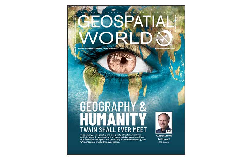
Geography & Humanity: Twain Shall Ever Meet
Topography, demography, and geography affects humanity in multiple ways. As we stand at the crossroads between transition to a new industrial epoch and precluding a climate emergency, the ‘Where’ is more crucial than ever before.
JANUARY - FEBRUARY 2022 » VOLUME 12 » ISSUE 01

در این شماره از مجله نقشه برداری Geospatial World ماه ژانویه و فوریه 2022 می خوانید:
Powered by innovation, the geospatial industry is bucking up for a new era defined by connectivity and convergence.
September - October 2021 » VOLUME 11 » ISSUE 08

در این شماره از مجله نقشه برداری Geospatial World ماه نوامبر و دسامبر 2021 می خوانید:
Digital Rise : The Transformation of the AEC Sector is Taking Place Due to Digitalization, Which is Enabling The Use of Cutting-Edge Technologies Solutions.
September - October 2021 » VOLUME 11 » ISSUE 08

در این شماره از مجله نقشه برداری Geospatial World ماه سپتامبر و اکتبر 2021 می خوانید:
WHEN VIRTUAL IS FOR REAL GEOSPATIAL INFRASTRUCTURE LIES AT THE CORE OF DIGITAL TWINS, WHICH CAN HELP US MAKE OUR SOCIETIES, ECONOMIES, BUSINESSES, AND ENVIRONMENT BETTER
July-August 2021 » VOLUME 11 » ISSUE 08

در این شماره از مجله نقشه برداری Geospatial World ماه جولای و آگوست 2021 می خوانید:
Earth Observation the Growth Story :
Earth observation data in surveying engineering.
May-June 2021 » VOLUME 11 » ISSUE 07

در این شماره از مجله نقشه برداری Geospatial World ماه می و ژوئن 2021 می خوانید:
where is the answer :
Location intelligence is one of the most fast growing technologies in surveying engineering.
March-April 2021 » VOLUME 11 » ISSUE 06

در این شماره از مجله نقشه برداری Geospatial World ماه جولای و آگوست 2020 می خوانید:
Geography Matters to NATO :
the growing realization about the power of ‘where’ is resulting in geo-intelligence gaining greater significance in the field of defense and security globally.
JULY-AUGUST 2020 » VOLUME 11 » ISSUE 02

در این شماره از مجله نقشه برداری Geospatial World ماه جولای و آگوست 2020 می خوانید:
Road to Recovery: The year 2020 has a lot more to offer for the geospatial industry, especially since it is one of the enabling pillars of the Fourth Industrial Revolution. Though the industry as a whole may see a timely recovery, different segments would fare differently.
MAY-JUNE 2020 » VOLUME 11 » ISSUE 01

در این شماره از مجله نقشه برداری Geospatial World ماه مه و ژوئن 2020 می خوانید:
As we celebrate 75 years of UN Charter, a look at 2020 & elasticity of the world order
MAR-APR 2020 » VOLUME 10 » ISSUE 06

در این شماره از مجله نقشه برداری Geospatial World ماه مارس و آپریل 2020 می خوانید:
Better regulations to benefit space industry: Dr. Scott Pace
How geospatial data and technologies can help in disease prevention and control
The China way: Use of technology to combat Covid-19
Pandemic: Geospatial technology can help in prevention, control and protection
Importance of gridded population data in decision making
Geospatial tech critical for building a sustainable world
Spirent SimHIL brings Realistic GNSS Simulation to Automotive HIL Testing
Year of consolidation for the geospatial industry
Open data is the future: Sean T. O’Brien, President and CEO, NatureServe
Tracking and understanding the impact of humans on environment
Reinventing economics for the age of autonomy
JAN-FEB 2020 » VOLUME 10 » ISSUE 05

در این شماره از مجله نقشه برداری Geospatial World ماه ژانویه و فوریه 2020 می خوانید:
It isn’t disruption; it’s continuum of evolution
Future of data privacy: The balancing act
Geospatial industry skill gap: Ways to build the best workforce
GIS as intelligent nervous system for the planet
Innovation, disruption and sustainability
Autonomous future for sustainable living
Investment in innovation at core of business
Integration of geospatial and AEC is inevitable
Geospatial at the core of resource management
How we monitor Earth – Payam Banazadeh, Capella Space
Geospatial data must for more efficient society
Geospatial Data, AI opening new business avenues
Digitalization process is accelerating development of new geospatial technologies
How is location integral to modern life
Geospatial industry trends 2020: Be disruptive or be irrelevant
Looking at opportunities on the margins
Exploring true potential of 3D geospatial
Digitalization redefining everything
Spatial data critical to intelligent enterprise
Data powering digitalization
Wireless location gets indoor and in 3D
Working with full innovation approach
Geospatial by default is the new paradigm
Launching new products, services for better growth
Being on-board with consumer
Geospatial data for an interconnected world
How technology is used in business and society
The revolutionizing third dimension
Geospatial can Positively Impact Every Industry
AI potential still underutilized
Harnessing true potential of geospatial data
Geospatial to weather economic storms
Finding all-around solutions
Providing complete digital environment to AEC Industry
Today’s technology with tomorrow’s vision
Automation is must for data-driven decisions
Geospatial to manage global change
Time for innovation is now
Bridging the gap in data analytics
How data is fueling technology advances
Better data, better outcomes
Maps empowering people, businesses
Managing all those drones
Data analytics offer new opportunities
Managing data smartly
Best of geo and AI for better decisions
Moving towards automated mapping
5G, data revolutionizing drone industry
Following geo-solutions business model
Petabytes of geospatial data to bite-sized actionable insights
Open Source mapping enabling businesses
Roadblocks in embracing AgTech
Geospatial solutions adding value
Data for better future
Evolving digitalization creating new business models
Right data for accurate analysis
Democratizing access to geospatial intelligence
Geospatial driving innovations in multiple domains
Drone solutions for better decision-making
Customer-first Approach for Higher Growth
Fast forward digitalization
Mapping for the future of mobility
Tech for awareness