


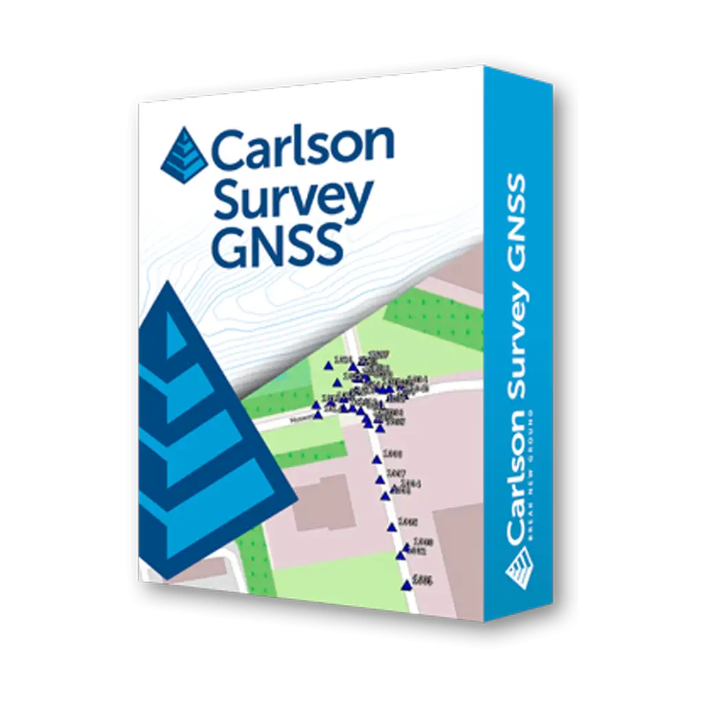

نقد و بررسی : نرم افزار نقشه برداری Carlson SurveyGNSS
نرم افزار نقشه برداری Carlson SurveyGNSS محصولی حرفه ای با طراحی مدرن و قدرت محاسباتی بالا برای پس پردازش داده های خام گیرنده های ایستگاهی GNSS از شرکت آمریکایی Carlson می باشد.
این نرم افزار بر روی پلت فرم های ویندوز 7، 8، 8.1 و 10 ارائه شده است.
همچنین با نسخه های 32 بیتی و 64 بیتی از ویندوز سازگار است اما برای استفاده از امکانات پیشرفته این نرم افزار از نسخه سری 7 تمرکز این شرکت فقط بر روی ارائه نسخه 64 بیتی می باشد.
نرم افزار Carlson SurveyGNSS هم اکنون به عنوان یکی از پرکاربردترین و جامع ترین نرم افزارهای نقشه برداری پس پردازش در سراسر دنیا از سوی نقشه بردارن امریکا مورد استفاده قرار می گیرد.
زیرا دارای انواع و اقسام برنامه ها و توابع بسیار کاربردی و کارآمد است.
این محصول کاربرپسند با داشتن ابزارهای ترسیماتی قدرتمند، فرد را از انجام ترسیمات و محاسبات دفتری تقریباً بی نیاز می سازد.
نرم افزار نقشه برداری Carlson SurveyGNSS برای کار با انواع گیرنده های GPS/GNSS مورد استفاده قرار گیرد.
همچنین ابزار محاسباتی و ترسیماتی فوق العاده قدرتمند باعث می شود که کاربر به راحتی ترسیمات مورد نیاز خود را تا حد امکان انجام دهد و خروجی مورد نیاز خود را تهیه نماید.
در نسخه مربوط به گیرنده های GNSS/GPS نیز برنامه ها و ابزارهای کامل برداشت و پیاده سازی وجود دارد.
به علاوه اطلاعات کاملی از سیستم های ناوبری، موقعیت و وضعیت گیرنده و وضعیت دریافت تصحیحات و … روبروی کاربر قرار دارد.
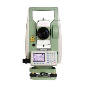
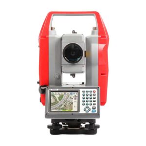
این نرم افزار را می توان بر روی انواع توتال استیشن های یا تبلت ها و یا دستگاهایی که دارای سیستم عامل Windows می باشند نصب و استفاده کرد.
گیرنده های GNSS (یا همان Global Navigation Satellite Systems) به معنی سیستم های ماهواره ای ناوبری جهانی هستند و برای شناسایی موقعیت فعلی، مسیریابی و تکمیل نقشه های جاده ها مورد استفاده نقشه برداران قرار می گیرند. به طور کلی کاربردهای فراوانی برای GNSS تعریف شده است که از میان آن ها می توان مواردی مانند ناوبری یا هدایت (از دستگاه های کوچک دستی تا ماشین ها، کشتی ها و هواپیماها)، تنظیم زمان، وارد کردن اطلاعات در نقشه های جغرافیایی، علوم ژئو فیزیک، رهگیری اشیاء و…. را نام برد.
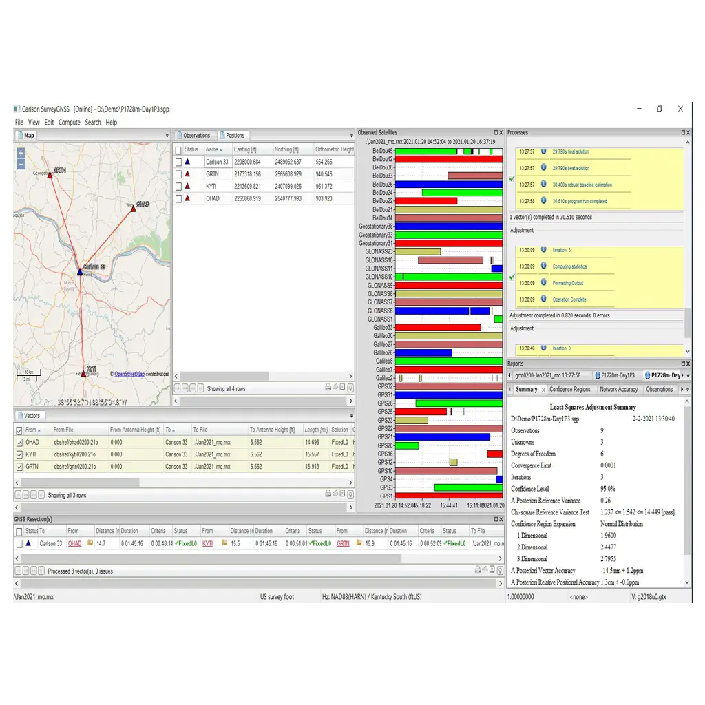
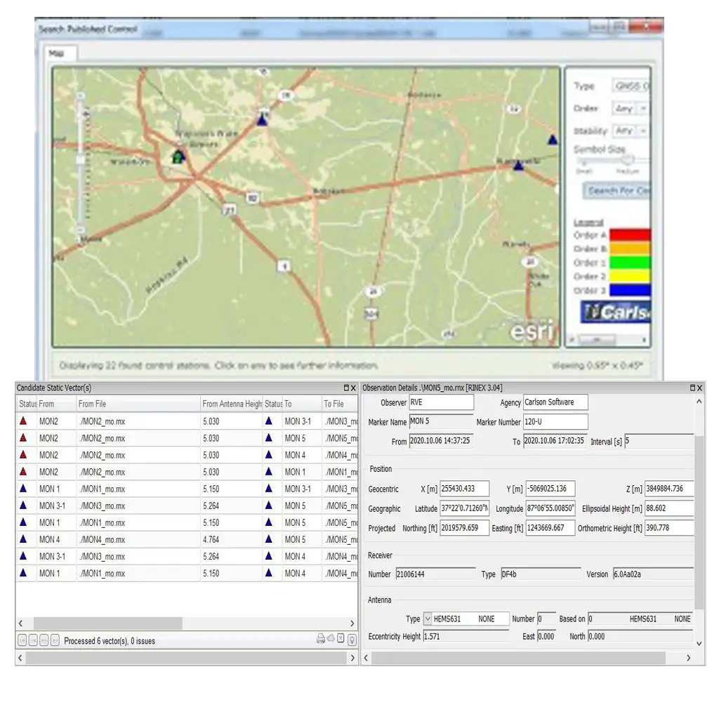
نرم افزار نقشه برداری Carlson SurveyGNSS دارای یک محیط پس پردازش (post-processing) برای داده های خام حاصل از گیرنده های GNSS میباشد. در این نرم افزار پیشرفته می توان با رصد کردن کدهای همزمان و فازهای حامل دریافتی از ماهواره های GNSS، به محاسبه ی بردارهای مختصات ها با کیفیت و دقت بالا و در نهایت تعیین موقعیت برآیند آن ها، پرداخت. با استفاده از این نرم افزار می توان نقشه های هوایی مطمئن تر و با کیفیت تری را تهیه نمود. قمرهای ماهواره ای (Satellite constellations) و سیگنال های ارائه شده توسط United States NAVSTAR GPS, Russian Federation GLONASS و دیگر ماهواره های مبتنی بر SBAS پشتیبانی می شوند.
قابلیت های کلیدی نرم افزار Carlson SurveyGNSS:
– بدست آوردن بالاترین دقت نتایج یک منطقه
– وارد نمودن داده های GNSS با فرمت RINEX
– رابط کاربری تعاملی به همراه جدول،نقشه و نمودار
– بهبود کیفیت فرکانس سیگنال داده های GIS
– یکپارچگی و سازگاری کامل با نرم افزارهای Carlson SurvCE, SurvPC و Carlson office
– کنترل کیفیت داده های GNSS قبل از خروجی گرفتن برای نرم افزار Survey یا GIS
Carlson SurveyGNSS
Carlson SurveyGNSS provides a robust post-processing environment for computing high quality vectors and resultant positions using simultaneous code and carrier phase observations of pairs of Global Navigation Satellite Systems (GNSS) receivers. Satellite constellations and signals provided by the United States NAVSTAR GPS, Russian Federation GLONASS, and various satellite based augmentation systems (SBAS) are supported using either single or dual frequency receiver equipment.
About CARLSON SURVEYGNSS
Designed for surveyors and positioning professionals, Carlson SurveyGNSS is a simple, yet powerful post-processing software that achieves high accuracy results for computing quality vectors and resultant positions.
Key features include:
Import GNSS observations from any GNSS receiver in RINEX and other proprietary formats
Achieve high accuracy results in areas with limited or no real-time corrections
Get intuitive user interface with tables, maps and graphs
Interact efficiently with Carlson SurvCE, SurvPC and Carlson office software
Do quality control of GNSS data before export to Survey or GIS software
SURVEYGNSS KEY FEATURES
Achieve high accuracy results in areas with limited or no real-time corrections
Process static, kinematic and “stop & go” raw data
Least squares adjustment including statistical testing
Optimized for processing data from all 4 “major” constellations (GPS, Glonass, Galileo, BeiDou) from capable GNSS receivers such as the Carlson BRx7
SurveyGNSS can also process data from the Indian Regional Navigation Satellite System (IRNSS)
Import GNSS observations from any GNSS receiver in RINEX format
Accept GNSS observations in a variety of proprietary formats
An intuitive user interface with tables, maps and graphs
Improve the quality of single frequency GIS data
Interact efficiently with Carlson SurvCE, SurvPC and Carlson office software
Do quality control of GNSS data before export to Survey or GIS software
CARLSON SURVEYGNSS AT A GLANCE
• Supports differential post-processing of RINEX GNSS observations in static, ‘stop and go’ and kinematic positioning modes
• GNSS observations from any GNSS receiver in RINEX format
• Accepts proprietary GNSS observations in the following formats:
Rinex: v2, v3
Carlson: .log and .rw5
Hemisphere GNSS: .bin
Altus: .sbf
Javad: .bin
NovAtel: .log
FOIF: .f**
Leica: .m00, lb2
NVS: .nvs
Septentrio: .sbf
Sokkia: .tos, .pdc
Topcon: .tps
Trimble: .dat, .t**, .r**
ublox: .ubx
– Additional proprietary manufacturer file formats will be added based on manufacturer cooperation and/or customer demand
• Provides a straightforward, workflow-oriented user interface including an overview map and observation files, computed vectors, and positions presented in fully functional spreadsheet-like grids
• Incorporates a proven state of the science, highly autonomous baseline processor offering on-the-fly ambiguity resolution, automated cycle slip detection / removal, and more for baselines up to 200km (125mi)
• Automated search and retrieval of reference geodetic control and GNSS observations from organizations such as the US National Geodetic Survey and Continuously Operating Reference Station (CORS) networks
• Automated search and retrieval of SP3 precise ephemeris files as well as ionosphere model files
• Rigorous least squares adjustment of all computed vectors
• Seamless integration with downstream applications from Carlson and other vendors
• Ready for the future: support of Galileo, BeiDou and Juntencho signals as soon as these become commercially available
• SurveyGNSS now also works offline. Typical online functionality (downloading reference station data, background map) will not be available. Vector processing is available, as well as GNSS Resection(s)
OPTIONAL FEATURES
• SurveyGNSS supports Precise Point Positioning (PPP) as a separate module. Raw data from any single or dual frequency phase data receiver can be used for PPP processing. There is no need for a base or reference network; the receiver can log data autonomously. Depending on observation time, centimeter-accuracy is achievable.
• SurveyGNSS uses locally available Positions and associated Observations to compute GNSS Resections and Virtual Reference Stations. The Virtual Reference Station is created as a RINEX file. The VRS can be used as base in both static and stop and go surveys.
مشخصات فنی : Carlson SurveyGNSS
| برند | |
|---|---|
| کشور سازنده | آمریکا |
برای نوشتن دیدگاه باید وارد بشوید.


دیدگاهی ثبت نشده.