


بروز رسانی نرم افزار نقشه برداری STONEX Cube Manager
انتشار بروز رسانی نرم افزار نقشه برداری STONEX Cube Manager
بروز رسانی نرم افزار نقشه برداری STONEX Cube Manager یک نرم افزار حرفه ای پردازش داده های تجهیزات نقشه برداری مختلف می باشد که توسط کمپانی استونکس ایتالیا منتشر گردید.
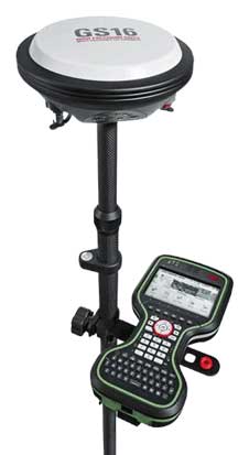
- پس پردازش داده های گیرنده های ایستگاهی GNSS به صورت STOP&GO ، کینماتیک، استاتیک برای یک یا چندین گیرنده و پردازش شبکه گیرنده ها.
- پردازش مدل سه بعدی نقاط.
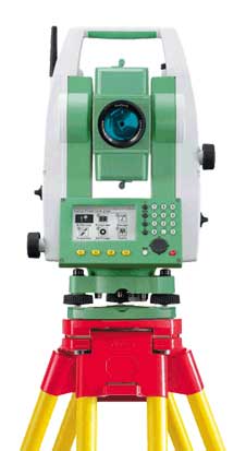
- تخلیه اطلاعات و پردازش داده های توپوگرافی از توتال استیشن، تئودولیت و ترازیاب های دیجیتال استونکس.
- کد قدرتمند برای ترسیم و پردازش داده ها.
- قابلیت import و export داده ها با فرمت های مختلف به نرم افزار.
نرم افزار استونکس کیوب منیجر یک نرم افزار قدرتمند با تمام ویژگی های نسخه های پیشین می باشد.
بروز رسانی های نرم افزار کیوب منیجر استونکس در کنار افزودن ویژگی های کاربردی دارای بهبود در رابط کاربری نرم افزار نیز می باشد.
این نسخه که برای ویندوز 10 با طراحی جدید ارائه شده است قابلیت اجرا بر روی نسخه های پیشین ویندوز (8.1 و 7) را دارا است.
نسخه جدید این نرم افزار در دو نسخه 32bit و 64bit به کاربران محترم ارائه می گردد.
نسخه جدید نرم افزار STONEX Cube Manager بسیار کاربرپسند می باشد و از دستگاه های زیر پشتیبانی می کند :
- توتال استیشن های استونکس مدل های R2 Plus L , R2W, R25 , R35 و R80
- ترازیاب های دیجیتال استونکس مدل D1 و D2
- گیرنده های استونکس سری S10 , S900 , S800, S9i, S9IIIPlus , S750 , S850 , S900 New, S980, S990
- اسکنر لیزری X300
همچنین فرمت های خروجی مختلف از جمله خروجی idx. لایکا در نرم افزار استونکس کیوب منیجر افزوده شده است.
یکی از نرم افزارهای منتخب مجله نقشه برداری GIM International می باشد که بسیاری از کاربران عمران و نقشه برداری از خود راضی نگهداشته است.

بروز رسانی نرم افزار نقشه برداری STONEX Cube Manager
منبع : سایت استونکس ایران
برای خرید لایسنس و دانلود نرم افزار استونکس کیوب منیجر ورژن 4.4 با بخش پشتیبانی استونکس در تماس باشید.
لیست بروز رسانی نرم افزار نقشه برداری STONEX Cube Manager را در ادامه این مطلب مشاهده نمایید.
Stonex Cube-manager
Copyright (c) 2017-2022 Stonex Srl
تغییرات اعمال شده در بروز رسانی نرم افزار نقشه برداری STONEX Cube Manager ورژن V4.3 به شرح ذیل می باشد :
UPDATE INFO / RELEASE NOTES
v4.4.20210424 released on April 24, 2021
- – GPS post-processing: date/time decoding fixes for RINEX 2.x – Fixes to unit conversions – Other minor bug fixes.
v4.3.20210412 released on April 12, 2021
- – Shapefile export: optional automatic conversion of polylines, with equal first and last vertices, to closed polylines – Bug fixes.
v4.3.20210402 released on April 2, 2021
- – Bug fixes. – Support for Stonex R20 total station.
v4.3.20210218 released on February 18, 2021
- Post-processing: – Fixes to the RINEX parser.
v4.3.20201005 released on October 5th, 2020
- Post-processing: – Post-processing has been fixed and its speed is back to normal.
v4.3.20201001 released on October 1st, 2020
- Post-processing: – Fixed SNR minimum level handling. GPS: – Fixed height problem assignment to points when a geoid file was not selected.
v4.3.20200906 released on September 6, 2020
- Cube-a import: – Fixes to support changes in the database structure which were causing the program to crash on import. RW5/RAW import: – Some bug fixes.
v4.3.20200721 released on July 21st, 2020
- Total Station: – Fixes in polar point stake-out – AntasMobile CSV survey import: added re-stationing detection — NEW — SDR33 file import support – Fixes in USB direct import
- CAD: – improvements in COGO commands
- Coordinate Conversion: — NEW — Add and edit points in geographic table and cartesian table command
- Geoids: – added new Latvian geoid
- Fixes in DXF/DWG export
- Fixes in Google Earth export
- Some minor bug fixes
- STONEX Cube Manager Software Update
v4.3.20200424 released on April 24th, 2020
- Modeling: — NEW — The TIN engine has been completely redesigned — NEW — Multiple Profiles command
- Total Station: — NEW — R2L+ and R25 – reference points can be selected and imported directly from the survey file – It is now possible to export using the r15 file extension – Re-calculation of fieldbooks enhancements
- GPS: – Post-processing enhancements
- Fixes in KLM export
- Fixes in Pregeo (Italy) export
- — NEW — Import of georeferenced raster (GeoTIFF)
- Fixes in SHAPEFILE import
- Some minor bug fixes
v4.3.20200218 released on February 18th, 2020
- GPS: – Postprocessing, corrections in the management and insertion of the calculation parameters – Import Cube-a updated for compatibility with its latest version – Google KML export enhanced – Polish report for GPS import updated
- TS: – Bug in fieldbook view-Prism Height fixed – Now can read slope distances and vertical angles for orientation points of R15 – IDX file format now writes DMS coordinates – RW5 import enhanced
- CAD: – Polylines commands all enabled now – Bug fixing in graphics in calculating the limits of the drawing
- Text files export enhanced
- Added SLD99, Reference System of Sri Lanka
- Corrections in the use of the WGS84 ellipsoid in the 7-parameter calculation
v4.3.20200115 released on January 15th, 2020
- Bug fixing in graphics in calculating the limits of the drawing
v4.3.20200114 released on January 14th, 2020
- — NEW — Mean center command averages coordinates of nearby points
- Fixes in export Shapefile
- Fixes in export TXT files
- Bug fixing in graphics
v4.3.20191219 released on December 19th, 2019
- Export Shapefile improved
- Fixes in graphics
- Some bug fixes (post-processing, export Cube-a, fieldbook view copy-paste function )
v4.3.20191210 released on December 10th, 2019
- Rototranslation: better tiepoints/common points management
- Import of Stonex R5/R6 ASC fieldbooks
- Various bug fixes
v4.3.20191204 released on December 4th, 2019
- Some bug fixes (undo of CAD editings)
v4.3.20191202 released on December 2nd, 2019
- New version v4.3 (commands available and enabled based on the active license):
- Post-processing (module P2, L1+L2)
- Topography (module T)
- Modelling (module M)
- User interface: — NEW — Editing of fieldbook data through simple grid views
- Post-processing: — NEW — Satellite analysis on single observation
- DXF/DWG: – improvements in export and visualization
- CAD: – improvements in images linked to topographic points
- Pregeo: – fixes in import
- Text file import-export: – fixes in export text file GPS LocalTime
- Total Station: – fixes in GSI import and export – fixes in import of R1Plus – improvement in R25 stakeout point readings
- STONEX Cube Manager Software Update
- GPS: – fixes in GeoGIS export – fixes in RW5 auxiliary points creation
- Geoids: – added various new geoid files
- Manuals: – Italian manual and English manual updated
v4.2.20190725 released on July 25, 2019 This is a cumulative update, it includes all changes to the application that have been released by targeted updates and beta releases distributed between October 2018 and July 2019
- User interface: — NEW — Restyling and new icons – fixed bug on window minimization (for example having the Topography tab selected)
- Post-processing: — NEW — Kinematic (Stop&Go + Kinematic) calculation — NEW — Static with multiple bases calculation — NEW — GPS Network adjustments – occupation time bar enhanced – improvements in variance-covariance matrices results – improvements in the workflow – added support for Compact Rinex
- CAD: — NEW — Select internal points (allows to select points inside perimeters, active with open or closed polylines, circles and boundaries) – fixes in calculation of polygon area – Rename points command, now can rename both single and multiple points – some commands added (eg Edit line) – fixed a problem in Characteristic points command
- Internationalization: — NEW — Polish translation — NEW — French translation — NEW — Spanish translation
- Total Station: – fixes in the assignment of coordinates to the backsight points – improvements in the calculation of reduced distances – fixes in the window shown to setup the orientation of the first station – fixes in the import of Pregeo DAT – support R15 / R25 – free stationing calculation improvements – improvements in report generation – data import improvements for R1plus / R15 – export data improvements – import of Cube-H24 added
- GPS: – fixes in the export of Pregeo DAT (PDOP value) – updated GNSS raw data to RINEX converter – reference station points now stored in a hidden layer (default option) – RW5 improvements – fixes in automatic “AutoBase” creation – possibility of changing the geographical coordinates – automatic recalculation of GPS coordinates when grid coordinates are changed and vice versa – stakeout, made compatible also with local systems – baseline end points are now stored as 3D ECEF vectors with respect to the reference base (the variation of the base coordinates will produce the consequent variation of the coordinates of the end points) – import Pregeo-EMP added – fixes in import images from Cube-a and GeoGIS format – fixes in import from USB for GeoGIS and RW5 format
- Reference systems: – improvements in the transformation between ETRF2000 and ETRF89 – possibility of selecting a reference system as default for new jobs – possibility of searching in the entries of the reference system by keyword (country, projection – datum) – Cassini-Soldner calculation improvements – fixes in import data with coordinates defined in the field
- Cube-a: – fixes in the conversion of entities drawn in the field (shapes could get deformed) – improvements to the import and conversion of projects containing graphical entities
- GeoGIS: – improvements to the import and conversion of projects containing graphical entities
- DB: – improvements in Create GeoGIS DB command
- DXF: – export improvements (eg simple text export option for compatibility with third-party applications)
- Import of survey data: – improvements in the calculation of averaged points
- Text file import-export: – added possibility to import geographical coordinates – bug resolution and possibility to export the base data – fixes in the header generation – new predefined import formats and possibility of customizing new formats
- Geoids: – added direct support for geoids in the UGF format (the same format of Cube-a geoid files) – added USA NGS geoids (full grids, CONUS and other zones) – added Colombian geoid (GEOCOL04)
- STONEX Cube Manager Software Update
- Fieldbook: – each topographic point now shows a list of coordinate origins (from which the calculation of the average coordinates will derive)
- Raster Images: – Fixed the GeoTIFF generation which was failing on 64-bit systems – improvements in GeoTIFF image conversion
- Data download from digital level: – improvements in serial data communication
- Create map command: – improvements in the automatic conversion of local coordinates to GPS
- Manuals: – Italian manual and English manual updated
v4.2.20181011 released on 11th October, 2018
- Fixes to RW5 import.
v4.2.20181003 released on 3nd October, 2018
- Fixes to “DAT to RINEX” conversion.
- Fixes to “Equidistant points or with step” command.
- Fixes to “Translate points” command.
v4.2.20180927 released on 27th September, 2018
- Fixed some stability issues.
- Fixes to GeoGIS export.
- Fixes to Cube-a import.
- Fixes to RINEX 2.10 import.
v4.2.20180917 released on 17th September, 2018
- Fixed some stability issues.
- Fixes to GeoGIS import.
v4.2.20180809 released on 9th August, 2018
- Fixed some stability issues.
- Fixes to RW5 import/export.
- Fixes to Cube-a import.
- Import from GPS raw files now creates also the points of the reference stations.
v4.2.20180802 released on 2nd August, 2018
- Fixed some stability issues.
- Fixes to R1+ and R2+L imports.
- Fixes to Cube-a import.
v4.2.20180727 released on 27th July, 2018
- Minimum .NET version is now 4.5 (was 4.7.2).
- Fixed some stability issues.
- Fixes to R1+ and R2+L imports.
- STONEX Cube Manager Software Update
v4.2.20180724 released on 24th July, 2018
- Fixed some stability issues.
- Fixes to various imports.
v4.2.20180716 released on 16th July, 2018
- Fixed some stability issues.
- Fixes to post-processing.
v4.2.20180616 released on 16th June, 2018
- Fixed some stability issues.
- Fixes to RW5 import/export.
- Fixes to Total Station data import.
- Fixed and enhanced the module “P” (post-processing):
- base coordinates can be specified at ground (or ARP) or at phase center.
v4.2.20180531 released on 31st May, 2018
- Fixed some stability issues.
- Fixes to GSI export.
v4.2.20180523 released on 23rd May, 2018
- Fixed some stability issues.
- Fixed some height problems in Pregeo DAT I/O (Italy).
- Fixed and enhanced the module “P” (post-processing):
- fixes in RINEX v2.x reading
- added (optional) auto-calculation of approximate base station coordinates from RAW data
- added input of antenna height for base station.
v4.2.20180509 released on 9th May, 2018
- Fixed some stability issues.
- Fixed some parameters in the reference system definitions.
- Fixed and enhanced the module “P” (post-processing):
- fixes in RINEX reading (antenna name extraction, SBAS)
- point names can now be changed from the post-processing grid
- added support for Hemisphere BIN raw data files
- added support for raw data decoding also when specifying the Base data
- STONEX Cube Manager Software Update
v4.2.20180426 released on 26th April, 2018
- Fixed some stability issues.
- Fixed and enhanced the module “P” (post-processing):
- fixes in RINEX reading
- fixes in static processing
- fixes in handling of phase center offsets
- the base station coordinates can now be changed
- the post processing window is now resizeable
- the position and size of the post processing window are now saved and restored.
- Fixed and enhanced the parsing of MicroSurvey FieldGenius RAW files (GPS).
- Fixed the “Create Map” command that was not working properly in the south hemisphere.
v4.2.20180420 released on 20th April, 2018
- This is the first public release of Cube-manager.