
مجله نقشه برداری GIM International
مجله نقشه برداری GIM International هر دو ماه یک بار از دفتر اصلی این ماهنامه نقشه برداری در کشور هلند منتشر می شود.
این مجله نقشه برداری (ژئوماتیک) با نام GIM International یک منبع آنلاین مستقل و باکیفیت برای همه علوم مرتبط با عمران و نقشه برداری است.
آین مجله نقشه برداری آخرین تحولات و تکنولوژی های روز صنعت جهانی ژئوماتیک ارائه می دهد: که شامل اخبار ، مقالات ، استخدام ، پروفایل شرکت های فعال ، مربیان و تقویم رویدادها مهم می باشد.
این مجله نقشه برداری اطلاعات گسترده ای در مورد همه مباحث اصلی در تجارت تجهیزات نقشه برداری را ارائه می دهد.
- نقشه برداری و سایر علوم مرتبط با نقشه برداری – Geomatics
- ژئودزی – Geodesy
- نقشه برداری هوایی و پهپادی – UAV
- سیستم داده های نقشه برداری – GIS
- فتوگرامتری – Photogrametry
- سنجش از دور – Remote Sensing
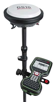
- گیرنده های GNSS / GPS
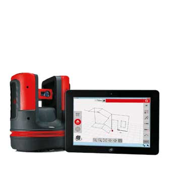
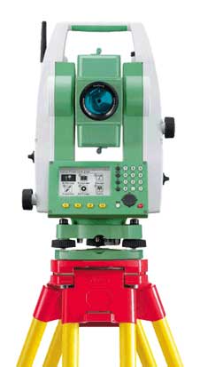
- توتال استیشن – Total Station
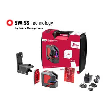
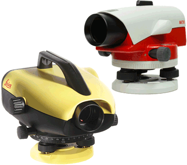
- سایر تجهیزات نقشه برداری
هر متخصص فن آوری زمین شناسی از طریق بخش اخبار مجله ، آنچه را که از جدیدترین تکنولوژی ها دنبالش می گردد ، پیدا خواهد کرد. هر شماره از مجله نقشه برداری GIM International جدیدترین به روزرسانی ها و پیشرفت های نقشه برداری را برای مخاطبان به ارمغان می آورد. بخش اخبار به مضامین خاصی مانند تجهیزات نقشه برداری Lidar ، UAV / UAS و GNSS – GPS و توتال استیشن های روباتیک و اسکنر های لیزری تقسیم می شود. بخش مقالات بینش عمیق تری از جمله مصاحبه با کارشناسان جغرافیایی ، ستون ها ی علمی و بررسی های موضوعی مربوط به صنعت ژئوماتیک را ارائه می دهد.
بانک اطلاعات جغرافیایی – Geo Database
جدا از ارائه اخبار و دیدگاه هایی درباره هنر نقشه برداری از زمین ، GIM International Magazine تلاش می کند تا پایگاه داده پیشرفته ترین اطلاعات جغرافیایی برای هر حرفه ای از جمله زمین شناسی و نقشه برداری باشد. دایرکتوری شرکت های موجود در این مجله یک دیتابیس بزرگ است که شامل بیش از 3000 شرکت فعال در نقشه برداری و داده های زمینی است و هر سازمان امکان انتشار اخبار استخدامی و شغلی ژئوماتیک خود را در بخش شغل های ویژه این مجله دارد.
از این گذشته مجله نقشه برداری GIM International یک بستر تبلیغاتی با مشخصات بالا را برای هر کنفرانس GIS ، نمایش پهپاد یا سایر رویدادهای مرتبط با ژئوماتیک در صنعت نقشه برداری را اختصاص می دهد. برای مثال ، ISPRS Daily یا Special INSPIRE را ببینید.
مجله جهانی نقشه برداری (ژئوماتیک)
GIM International بیش از 25 سال پیش راه اندازی شد و از آن زمان تاکنون به طور محکم خود را به عنوان مجله پیشرو جهانی در نقشه برداری و زمین شناسی ثابت کرد. به صورت دو ماهه ، یک شماره جدید به هزاران نفر از متخصصان در 170 کشور در سراسر جهان ارسال می گردد.
آخرین شماره از مجله نقشه برداری GIM International شامل نسخه الکترونیکی ماهانه به صورت PDF را می توانید بصورت رایگان از سایت disto.ir دانلود نمایید.
GIM - Issue 1 - 2024

در مجله نقشه برداری GIM International شماره 1 سال 2024 می خوانید:
GIM – Issue 1 – 2024
Our traditional annual Business Guide forms a vital resource for geomatics professionals. With in-depth articles and interviews, it reflects on geospatial trends and explores the business outlook for the industry. This issue also highlights digital twins and reality data capture’s transformative role in digitizing the worldheeft contextmenu
GIM - Issue 8 - 2023

در مجله نقشه برداری GIM International شماره 8 سال 2023 می خوانید:
GIM – Issue 8 – 2023
Geospatial data obviously is key to sustainable land management. But what are the common success factors for land administration and cadastral systems around the world? In this issue, we will focus on standards and solutions that make it easier to configure land administration workflows, including a selection of real-life examples.
GIM - Issue 7 - 2023

در مجله نقشه برداری GIM International شماره 7 سال 2023 می خوانید:
GIM – Issue 7 – 2023
To tie in with the Intergeo event, this edition will reflect on the practical digital twin-related challenges in the geospatial domain. While the concept of the digital twin has been gaining significant momentum in recent years, there are still some issues that need to be addressed. Which unique knowledge, skills and expertise can – and should – the geospatial domain contribute to turn digital twin solutions into reality?
GIM - Issue 6 - 2023

در مجله نقشه برداری GIM International شماره 6 سال 2023 می خوانید:
GIM – Issue 6 – 2023
This edition of GIM International is our annual showcase for challenging and exciting geospatial projects. Each year, we present some spectacular examples of how surveyors around the world have successfully overcome obstacles in their work. These insights into extraordinary real-life mapping and surveying adventures are a source of inspiration for geospatial professionals across the globe!
GIM - Issue 4/5 - 2023

در مجله نقشه برداری GIM International شماره 4/5 سال 2023 می خوانید:
GIM – Issue 4/5 – 2023
As robots and autonomous technologies become increasingly integrated into surveying workflows, how are they changing the way the physical environment is mapped? This edition will explore how robots can support geospatial professionals, and will include inspiring examples of how autonomous systems are already being used as cost-effective and easy-to-deploy tools for a wide range of aerial and terrestrial surveying tasks.
GIM - Issue 3 - 2023

در مجله نقشه برداری GIM International شماره 3 سال 2023 می خوانید:
GIM – Issue 3 – 2023
Special cameras and sensors allow surveyors to acquire images and other geospatial information about the Earth and the environment. While both image-based solutions and laser-scanning methods are evolving rapidly, there still is much debate about which technology is more efficient. This issue of GIM International presents intriguing examples of how the use of both imagery and Lidar supports increased accuracy and spatial resolution of the final products as well as faster and more cost-effective data services.
GIM - Issue 2 - 2023

در مجله نقشه برداری GIM International شماره 2 سال 2023 می خوانید:
GIM – Issue 2 – 2023
Welcome to the new GIM International! Our refreshed design and updated logo signal our commitment to innovation in the dynamic world of mapping and surveying. In this edition, we explore the transformative power of artificial intelligence (AI) in the geospatial industry, with features on the National Land Survey of Finland’s AI innovations, AI-powered climate resilience, and AI’s potential to solve the puzzle of georeferencing land deeds. Additionally, we examine the very latest digital twin techniques and how they can serve city planning needs. Join us in discovering how these cutting-edge technologies are advancing the geospatial industry. Stay ahead of the curve with GIM International.
GIM - Issue 1 - 2023

در مجله نقشه برداری GIM International شماره 1 سال 2023 می خوانید:
GIM – Issue 1 – 2023
In keeping with the evolving geospatial industry and the dynamic nature of mapping and surveying, GIM International has been revamped and now boasts a new and refreshed design – including an updated logo! The first edition of 2023, which in line with tradition is the annual Business Guide, is the first to showcase the modernized style. We hope you like the new look. As always, feel free to send us your feedback!
GIM - Issue 7 - 2022

در مجله نقشه برداری GIM International شماره 7 سال 2022 می خوانید:
GIM – Issue 7 – 2022
Analysing, distributing and visualizing geospatial data are all vital steps in the mapping and surveying workflow in order to turn geodata into a key driver of today’s information society and benefit the world as a whole. However, none of this is possible without gathering the data itself – and that in turn requires suitable platforms to carry out surveying projects. This issue of GIM International is dedicated to a wide variety of vehicles that all have one thing in common: the ability for sensors to be mounted on them for surveying purposes.
GIM - Issue 6 - 2022

در مجله نقشه برداری GIM International شماره 6 سال 2022 می خوانید:
GIM – Issue 6 – 2022
Creating extremely high-quality 3D data and models from survey data is critical for many applications, such as in the AEC industry and urban planning. This issue of GIM International enriches our readers’ knowledge of 3D and BIM workflows and software, not only in terms of photogrammetric image processing and Lidar processing but also how the resulting data is used in various processes and how the quality of the deliverables can be further improved.
GIM - Issue 5 - 2022

در مجله نقشه برداری GIM International شماره 5 سال 2022 می خوانید:
GIM – Issue 5 – 2022
Surveyors often have to carry out projects in harsh or remote environments. While this may not always be optimal for the land surveyors and other geomatics professionals involved, such projects result in great learning experiences. Further, geospatial technologies are applied for surprising tasks. This special edition of GIM International presents a prestigious selection of challenging survey projects that have led to some extraordinary mapping and surveying adventures, accompanied by stunning imagery.
GIM - Issue 4 - 2022

در مجله نقشه برداری GIM International شماره 4 سال 2022 می خوانید:
GIM – Issue 4 – 2022
Terrestrial mapping is a traditional survey method, but still often the most accurate solution for many mapping projects. Nowadays traditional techniques are often combined with an innovative mobile mapping solution based on mobile Lidar. This issue of GIM International focuses on state-of-the-art terrestrial mapping technology – not only today’s terrestrial laser scanners and other Lidar solutions, but also the wide range of applications of terrestrial survey data.
GIM - Issue 3 - 2022

در مجله نقشه برداری GIM International شماره 3 سال 2022 می خوانید:
GIM – Issue 3 – 2022
his issue puts aerial mapping centre stage. We zoom in on all the aspects that come into play when using state-of-the-art aerial remote sensing technology such as photogrammetry and Lidar for mapping and surveying purposes, but also on the wide range of applications of aerial survey data. Through a series of articles, we take a closer look at the latest aerial mapping platforms, systems and processes, along with the ever-expanding range of products and services derived from such systems.
GIM - Issue 2 - 2022

در مجله نقشه برداری GIM International شماره 2 سال 2022 می خوانید:
GIM – Issue 2 – 2022
Satellite surveying… are there any industry professionals out there not using it on (almost) a daily basis? In this issue of GIM International we highlight the recent developments in positioning and navigation systems and investigate how new solutions are set to bridge the gap between RTK and PPP. Additionally, we focus on the creation of a digital twin of Germany and on the development of a virtual terrestrial laser scanner simulator as a training tool to support the learning of laser scanning processes.
GIM - Issue 1 - 2022

در مجله نقشه برداری GIM International شماره 1 سال 2022 می خوانید:
GIM – Issue 1 – 2022
How is the geospatial industry evolving in today’s turbulent times? What are the trends and developments in the sector, and where is the business heading? Read the findings from GIM International’s recent annual industry survey for the answers to these and other questions. And needless to say, there is much more to discover in the latest edition of our annual Business Guide. Just some of the other highlights include Q&As with leading experts about the prospects for the surveying and mapping profession, and an overview of the opportunities presented by the digital transformation in the construction sector.
GIM International: November-December 2021

در این شماره از مجله نقشه برداری GIM International ماه نوامبر و دسامبر 2021 می خوانید:
GIM – Issue 7 – 2021
Surveying in the land of fire and ice, The Implementation of the Geodetic Datum in Iceland: A Challenging Journey
n the front cover of this issue of GIM International, a surveyor can be seen measuring a ground control point close to a crater in Geldingadalir, Iceland. Iceland’s dynamic geodetic situation can be challenging for surveyors, but it also presents opportunities for interesting and exciting projects. Maintaining the geodetic networks in Iceland is a never-ending task. To learn more, read the article titled ‘Surveying in the Land of Fire and Ice’ starting on page 18.
GIM International: September-October 2021

در این شماره از مجله نقشه برداری GIM International ماه سپتامبر – اکتبر 2021 می خوانید:
GIM – Issue 6 – 2021
As 3D models are becoming common geospatial data assets, this issue of GIM International reviews major modelling activities across the globe.
Jantien Stoter provides us with an essential update on the state of the art in 3D city modelling in the context of digital twins. We also explore how an underground 3D model helped the city of London save millions of pounds on the Crossrail 2 railway project. The continuing advancement of 3D mapping technology enables experimentation with the VR visualization of point clouds – a topical development for the geomatics community, as outlined in the contribution by Juho-Pekka Virtanen et al. And this is just a brief selection of what’s in store, since this bumper-packed issue of GIM International once again covers a huge variety of topics in a mix of articles, columns and interviews. Happy reading!
GIM International: July-August 2021

در این شماره از مجله نقشه برداری GIM International ماه جولای-آگوست 2021 می خوانید:
GIM – Issue 5 – 2021
Our Special ‘Prestigious Projects’ Edition
This summer issue features an article about Chernobyl in Ukraine, where Lidar is being used to map radioactive hotspots stemming from the meltdown of the nuclear power plant more than three decades ago. From there, we take you to the Indonesian island of Sumatra; our editor Wim van Wegen provides an insight into the deployment of UAV-Lidar in combination with BIM in a project to construct the 2,700km Trans-Sumatra Toll Road (see page 19). Travelling the world from behind his desk, Wim has also written an article about the much harsher and more remote archipelago of the Faroe Islands in the northern Atlantic to highlight a crewless aerial mapping project (see page 15). Meanwhile, on page 22 of this issue, you will find an interview with Chris Fisher. Besides being an archaeologist, National Geographic Explorer and professor of anthropology at Colorado State University, USA, Fisher is also founder of the Earth Archive.
GIM International: May-June 2021

در این شماره از مجله نقشه برداری GIM International ماه می و ژوئن 2021 می خوانید:
GIM – Issue 4 – 2021
The front cover of our brand new issue of GIM International shows Ljubljana Castle standing on a small hill in the center of the Slovenian capital, which was the site of an inspiring true orthophoto project featured in this edition of GIM International. On top of this, we zoom in on SfM photogrammetry for 3D terrain mapping and give you new insights on how innovations in Lidar technology are facilitating the work of surveyors. This is just a selection of the stories, we wish you a happy and inspiring read!
YellowScan Joins Forces with Dutch UAV Manufacturer
Enhanced Stockpile Reporting in UAV Surveying Software
FIG e-Working Week Headlines
Fugro to Deliver Gauging Survey and Digital Twin of Scotland’s Rail Network
Unearth Joins Trimble’s GIS Partner Programme
GIM International: March-April 2021

در این شماره از مجله نقشه برداری GIM International ماه مارس و آپریل 2021 می خوانید:
GIM – Issue 3 – 2021
his year’s third issue of GIM International is dedicated to aerial mapping. With a mix of content focusing on the latest in both photogrammetry and Lidar mapping technology, we aim to give you an overview of the current possibilities. We also shine a light on the benefits of capturing the environment with a manned aircraft.
P. 12 Recent Trends in Four Lidar Technologies
P. 16 Lidar Crop Classification with Data Fusion and Machine Learning
P. 21 Lidar or Photogrammetry? Why Not Use Both?
P. 25 EAASI Continues to Gain Height
P. 28 Building a 3D World: Common Sources of Elevation Data
GIM International: January-February 2021

در این شماره از مجله نقشه برداری GIM International ماه ژانویه و فوریه 2021 می خوانید:
Establishing an Accurate Geodetic Reference Network for Uganda
Facilitating Cadastral Surveys, City Developments and Road Construction
CREATING A SMART NATION: THE GEOSPATIAL APPROACH
UNLOCKING THE FULL POTENTIAL OF DRONES
WHAT IS GNSS SPOOFING?
What is GNSS spoofing?
How Real-time Monitoring Reduces Water Losses
Creating a Smart Nation: The Geospatial Approach
GIM Business Guide 2021 Issue 1

در این شماره از مجله نقشه برداری GIM Business Guide 2021 می خوانید:
GIM ISSUE 1 BUSINESS GUIDE
– INDUSTRY SURVEY: CAUTIOUS OPTIMISM
– EMERGING FROM COVID-19
– THE FUTURE OF GEOSPATIAL
– UNLOCKING POTENTIAL: GEO-TRENDS FOR BUSINESS
-TECH DRIVERS FOR SURVEYING
GIM International: May-June 2020

در این شماره از مجله نقشه برداری GIM International ماه نوامبر و دسامبر 2020 می خوانید:
داستان تصویر روی جلد
وقتی نوبت به ارزیابی تأثیر پذیز می رسد ، داده های سنجش از دور می توانند به موقع بودن ، دقت و ارتباط آنها را برای تصمیم گیرندگان افزایش دهند. 3ie و New Light Technologies در حال افزایش استفاده از تجزیه و تحلیل مکانی در IE هستند ، همانطور که می توانید در مقاله مربوط به این موضوع در صفحه 28 بخوانید. تصویر روی جلد این شماره نوامبر / دسامبر سال 2020 ، تشخیص گیاهان رشته های برنج را در یک تصویر ماهواره ای را نشان می دهد.
This issue contains the following articles:
P. 10 Farewell Interview with Senior Editor Mathias Lemmens
P. 15 Realistic Virtual Reality Environments from Point Clouds
P. 19 Bright Perspectives of Mapping from Above
P. 21 Developing an Online 3D Model of the City of Groningen
P. 27 Satellite Imagery: An Aerial Alternative
P. 28 Remotely Sensed Data to Increase the Effi ciency of Data Collection
GIM International: May-June 2020

در این شماره از مجله نقشه برداری GIM International ماه سپتامبر و اکتبر 2020 می خوانید:
GIM International: May-June 2020

در این شماره از مجله نقشه برداری GIM International ماه مه و ژوئن 2020 می خوانید:
– Integrating UAV-based Lidar and Photogrammetry
– How 3D Scanning Rebuilds Crime Scenes for Courtrooms
– The Anatomy of Corruption in Land Management
– Fit-for-purpose Land Administration for All
– Mapping the Yangtze River
– Modernization of Suriname’s Public Domain Cadastre
– The Evolution of FLEPOS 3.0
GIM International: March-April 2020

در این شماره از مجله نقشه برداری GIM International ماه مارس و آوریل 2020 می خوانید:
– How the New EU Directive Will Change the Geospatial Data Market
– GNSS Positioning at Centimetre Level for Dynamic Applications
– UAS Mapping – Where Is It Heading?
– The Main Issues to Consider before Using UAVs for Land Administration Projects
GIM International: January-February 2020

در این شماره از مجله نقشه برداری GIM International ماه ژانویه و فوریه 2020 می خوانید:
– 3D BIM Models for Heritage Asset Management
– Using Lidar North of the Arctic Circle
– Simultaneous Capturing of Lidar and Imagery
– 3D City Model and Augmented Reality
– Analysing Mean Sea Level Variations across the Hormuz Strait
– Indoor Mobile Mapping Goes Mainstream
مجله های نقشه برداری GIM International در سال 2021


مجله های نقشه برداری GIM International در سال 2020


مجله های نقشه برداری GIM International در سال 2019


مجله های نقشه برداری GIM International در سال 2018


تکنولوژی های جدید معرفی شده در این شماره از مجله نقشه برداری GIM:
- نرم افزار اندرویدی MicroSurvey FieldGenius Android که توسط کمپانی ماکروسرویی کانادا توسعه داده شده است.
- اسکنر های لیزری ZF با قابلیت رجیستر کردن مدل ها در محل سایت.
- همکاری شرکت پهپادی DJI برای برداشت داده های تصویری هوایی
- گیرنده های ایستگاهی پنتاکس ژاپن مدل G6Ni.
- راهکار جدید کمپانی Gexcel برای پردازش داده های 3D از چندین منبع GIM International Magazine.
- گیرنده ایستگاهی کمپانی CHC Nav i90.
- معرفی گیرنده ایستگاهی لایکا مدل GS18 T تحت لیسانس لایکا سویس.
- نرم افزار تخصصی STAR*NET 9 برای سرشکنی به روش کمترین مربعات توسط شرکت Microsurvey Canada.
- گیرنده R12 تریمبل امریکا مجهز به موتور ProPoint GNSS .
- اسکنر جدید GeoSLAM و تلفیق داده های جزئیات بالا با تصاویر کیفیت بالا.
- ورژن جدید ArcGIS برای فضاهای بسته پس از خرید کمپانی indoo.rs.
- سیستم های Mobile Mapping کمپانی SBG systems مجله نقشه برداری GIM مارس و آوریل 2020.
- معرفی گیرنده ایستگاهی SP85 SPECTRA.
- سیستم جدید تصویر برداری هوایی RIEGL VQ-780i.
- دقت بالای اندازه گیری با نرم افزار های EOS Positioning systems.
- سیستم های اسکنر سوت چین با هم کاری ریگل.
- گیرنده ایستگاهی استونکس STONEX S900A ساخت کشور ایتالیا با بالاترین استاندارد های اروپا.
- توتال استیشن سری R25 استونکس ایتالیا با قابلیت خروجی idx. و سایر خروجی های سفارشی توسط کاربران.
- توتال استیشن جدید مدل R-2500NS ساخت پنتاکس ژاپن و تحت لیسانس کمپانی بزرگ TI Asahi LTD.
- نرم افزار کیوب لینک استونکس با امکانات پیشرفته تخلیه اطلاعات از دوربین های توتال استیشن استونکس مدل R25.